Here’s What Climate Change and Urban Sprawl Look Like in Texas
The climate is changing, and Texas is growing. For a bird’s eye view of these developments, NASA has put together a ‘State of Flux‘ image gallery that shows how climate change, urbanization, and natural disasters have changed certain geographic features in Texas, and across the world. The gallery puts two satellite images side-by-side to show the changes.
We culled the images about Texas below, where you can see seven side-by-side comparisons that show the effects of drought and urbanization on the state. While not every weather and wildfire event below was directly caused by climate change, scientists say climate change has made them worse. (You can click on the photos to enlarge them.)
Drought Drains Lake Merideth
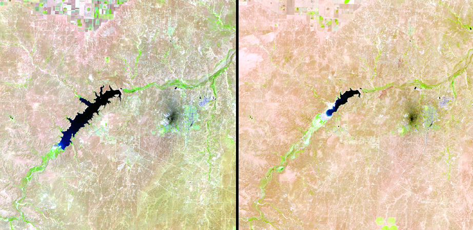
Photo by NASA
Photo dates (L-R): June 18, 1990 and June 12, 2011
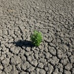
Lake Meredith is located in the Texas Panhandle, about 35 miles north of Amarillo. The picture on the right shows Lake Meredith at a record low of 26.41 feet after the 2011 drought. The bright green portions indicate areas of healthy vegetation growth.
After the jump: wildfires, sprawl and storm surges …
West Texas Wildfires
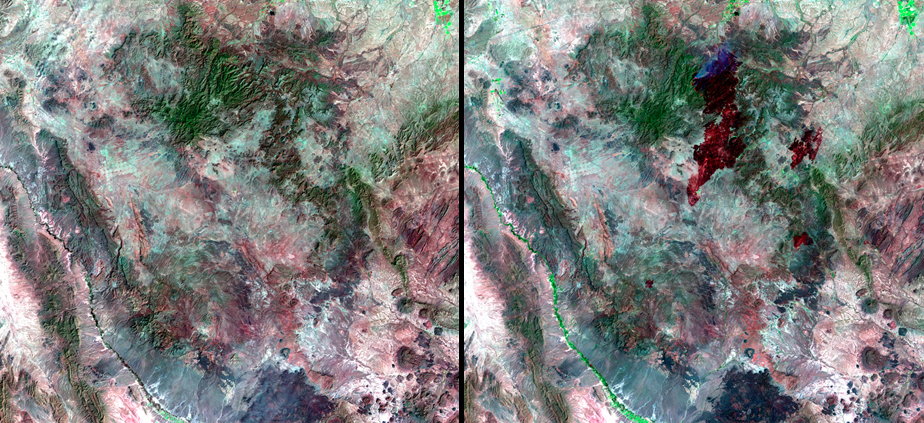
Photo by NASA
Photo dates (L-R): February 27, 2011 and April 16, 2011
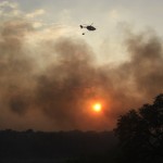
Dry conditions from Texas’ most recent drought made many parts of the state more susceptible to wildfires. This image shows the wildfires that burned through 400 square miles of west Texas between April 14 and April 16 in 2011. The fires also destroyed homes and other structures around Fort Davis. You can see grey smoke rising from an active fire at the top of burned patch.
The Permian Basin Boom, From Space
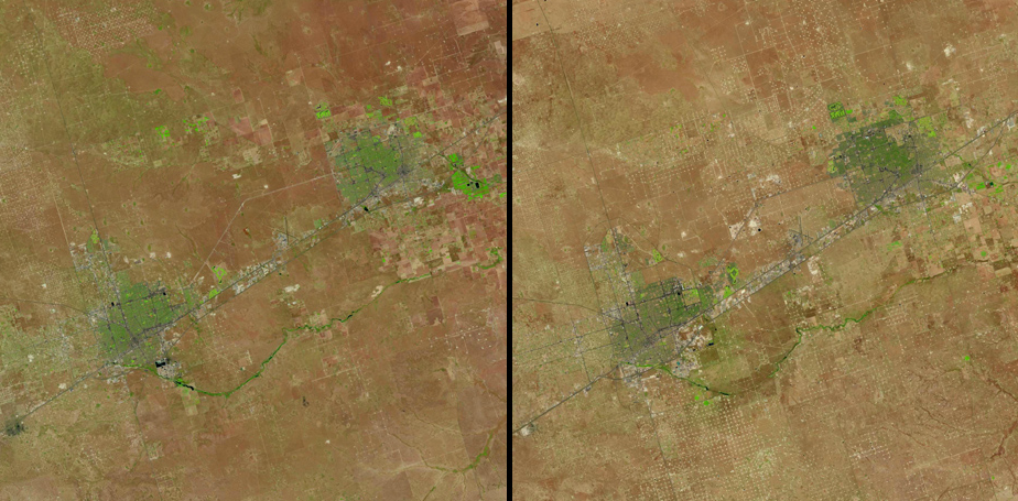
Photo by NASA
Photo dates (L-R): June 1, 1984 and June 1, 2013
These pictures show oil field expansion in the Permian Basin. The large green areas are cities, with Odessa on the left and Midland on the right. The white dots (which are most noticeable in the rural areas away from the cities) are oil wells. The growth is part of an oil rush that could beat the oil production records of the 1970s.
San Antonio Sprawl
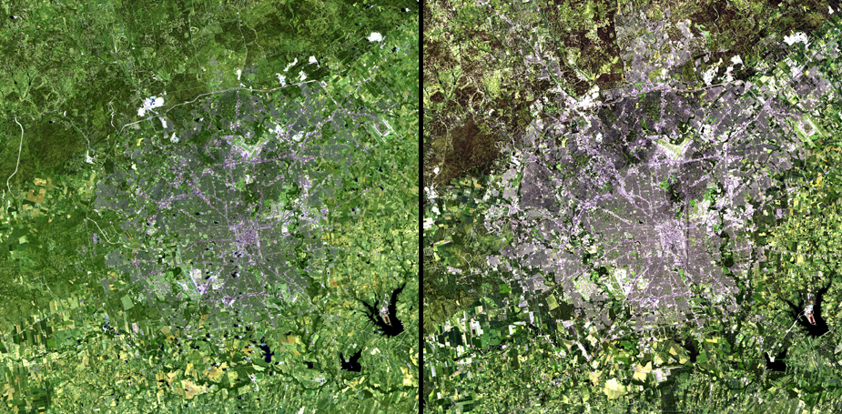
Photo by NASA
Photo dates (L-R): June 16, 1991 and June 4, 2010
Over the past 20 years, only three cities have grown faster in population than San Antonio. The city has grown from just 790,000 people in 1991 to over 1.4 million people in 2010.
Draining Lakes and Disappearing Vegetation
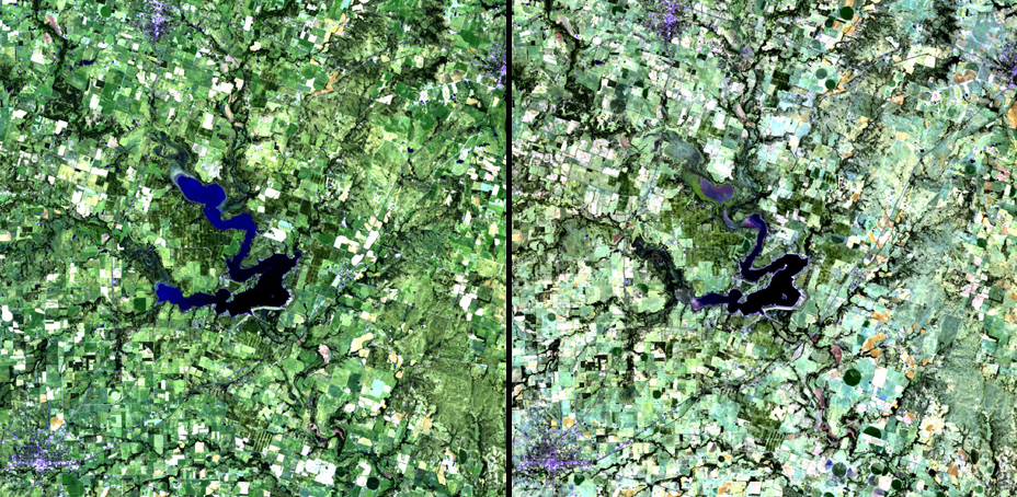
Photo by NASA
Photo dates (L-R): October 1, 2010 and October 4, 2011
Proctor Lake is 90 miles southwest of Fort Worth. The lake itself is lower because of drought, and the dimmer green colors in the second picture indicate how drought has diminished much of the vegetation around the lake.
Here Comes the Metroplex
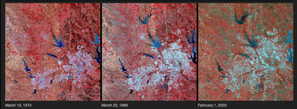
Photo by NASA
Photo dates (L-R): March 12, 1974, March 22, 1989, and February 1, 2003
Suburban sprawl has taken over the Dallas-Fort Worth Metroplex since the 1970s. The area’s population grew from about 2.4 million people in 1970 to 6.4 million in 2010.
Bastrop Burns
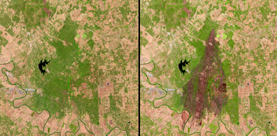
Photos by NASA
Photo dates (L-R): August 26, 2011 and September 11, 2011
Strong winds and dry conditions caused the Bastrop Complex fire, the most destructive wildfire in Texas history. This photo shows the extent of the devastation in Bastrop State Park. The fire killed two people, destroyed over 1,600 homes, and caused over $325 million in property damage.
Ike’s Storm Surge Inundates Galveston
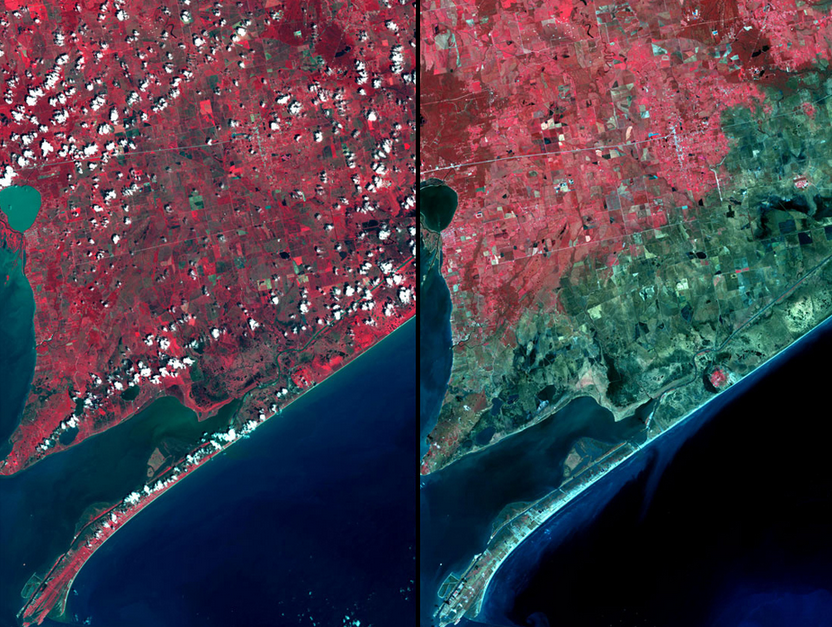
Photos by NASA
Photo dates (L-R): August 2008 and September 28, 2008
Hurricane Ike caused flooding throughout Galveston when it hit in 2008.* The blue-green portions of this photo indicate an area that is inundated with water.
Further reading:
- How Climate Change Will Impact Texas
- Five Ways Climate Change Threatens Energy in Texas
- What You Can Do About Climate Change