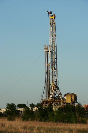
Yet another earthquake has rattled North Texas. Early Tuesday morning, the city of Keene, 25 miles south of Fort Worth, experienced what the U.S. Geological Survey says was a 2.4 magnitude earthquake.
“We’ve been looking at the question of whether the number of earthquakes occurring across the mid-continent has changed in recent years. And we find that there is a statistically significant increase in the rate just over the past several years. And many of these are in areas where we know there is a lot of energy activity,” U.S. Geological Survey geophysicist Bill Ellsworth tells StateImpact Texas.
There’s fear in Austin over what could happen if the state runs short of electricity and has to use rolling blackouts to keep the statewide electrical grid from collapsing.
The fear is for the state’s image.
At a meeting of the Texas Public Utility Commission (PUC) June 13th, Chairman Donna Nelson expressed concern that pleas to the public to conserve electricity during the late afternoon when demand is greatest might also send a message that Texas was running out of power and therefore was no place you’d want to do business. Continue Reading →
Congratulations, McMullen County, Texas. You officially have the highest number of farmers per capita in the United States. More than half of the population there are farmers (374 out of 707 people). The data comes from the U.S. Census Bureau and you can visualize it all in a new interactive map built by Slate, Agriculture in the U.S. and Around the World.
The farming belt stretches from Texas up to North Dakota, where in some communities, farmers are about a third of the population. Contrast that with the coasts, Slate notes, and you’ll find “just one or two out of every 100 people work as farmers, even in rural areas.”
In 1980, Congress passed a federal law to cleanup sites with excessive industrial contamination. These were places that were so polluted that they required long-term federal cleanups, and they’re known as Superfund sites. StateImpact Texas reporter Dave Fehling reports today that thirty years later, some of these toxic places are still being cleaned up.
In the map above you can see the many Environmental Protection Agency (EPA) Superfund sites in Texas. (There are also Superfund sites administered by the state environmental agency, the Texas Commission on Environmental Quality, that are not included on this map.) Some of the sites have been completely cleaned up (designated in green), while others are still being worked on (in red). Yellow points are places that have been proposed as EPA Superfund sites in Texas. Continue Reading →
Located in Galveston County, it was disposal site for millions of gallons of petrochemical waste
It’s the summer vacation season and on the way to Galveston, thousands of beach-goers drive right past it. It’s a 12 acre field that lies along the east side of I-45 right before you head over the causeway to Galveston Island. It’s doubtful many of the vacationers stop to look, but if they did, they might see a stone marker. It’s an historical marker, of sorts. In big letters it proclaims what is just the other side of a barbed wire-topped chain-link fence: the MOTCO FEDERAL SUPERFUND SITE.
It’s one of over 150 polluted Superfund sites in Texas. Some are under control of the Texas Commission on Environmental Quality. Many of the worst are managed by the U.S. Environmental Protection Agency. Continue Reading →
Photographer and author Thomas Bachand put the Keystone Mapping Project together. While he only has data for four states, he’s still hoping to map out the rest. In an email to StateImpact Texas he wrote that he started the project because “neither TransCanada Corporation nor the U.S. Department of State (DOS) have been forthcoming with this project’s GIS information. This has made it impossible to evaluate the potential environmental impacts of the Keystone XL pipeline,” he wrote. “While it’s a good start, the scarcity of data underscores the lack of transparency and inadequacy of the Keystone XL review process.”
A new map from the Texas Tribune shows water levels in lakes and reservoirs across the state.
A new interactive map from our friends at the Texas Tribune allows you to see up-to-date levels for major lakes and reservoirs in the state. The map was created by the Tribune’s environmental reporter Kate Galbraith and data reporter Ryan Murphy.
Although overall drought conditions have improved in much of the state, our water storage hasn’t fully recovered. As you can see from the Tribune’s map, many lakes and reservoirs in the western parts of the state are still no more than a quarter full. On the eastern half of Texas, however, nearly all of the lakes and reservoirs are between 75 and 100 percent full. You can see the map in full at the Texas Tribune.
In the latest drought monitor released today, over 17 percent of the state is completely drought-free. But much of the western part of the state is still in the worst stages of drought, as is clear in the map to the right. These new maps put in stark relief the difference between the two halves of the state in their recovery from the drought.
Just how much damage has the drought done to Texas? For the first time, you can see an interactive map and several visualizations that show just how severe the drought has been our new interactive web app, ‘Dried Out: Confronting the Texas Drought.’
The company behind the Keystone XL pipeline says they will go ahead and build the portion from Cushing, Oklahoma to refineries in Texas.
David Barer of StateImpact Texas contributed reporting and research for this article.
Today’s announcement that Canadian pipeline company TransCanada would start construction on a section of its Keystone XL pipeline from Cushing, Oklahoma to Texas didn’t come as a great surprise to those who have been watching the pipeline.
Ever since the Obama administration rejected TransCanada’s original request for a presidential permit to pipe tar sands crude from Alberta, Canada to the Gulf Coast of Texas, TransCanada officials have been talking about building out the project incrementally.
“Quite frankly we need a presidential permit for about 50 feet of pipe. If we weren’t crossing that border than we wouldn’t be having this conversation,” TransCanada Public Relations representative Jim Prescott told StateImpact Texas earlier this year. “We’re ready to start putting pipe in the ground.”
The company says completing this part of the pipeline will help it move a bottleneck of crude oil from Oklahoma to refineries on the Gulf Coast. The full pipeline project – which would move crude from Alberta, Canada to Texas – is being re-submitted for approval at the federal level.
Opponents of the pipeline greeted today’s news with weary resignation. Continue Reading →
We do a lot of reporting on the ongoing (but hopefully abating) Texas drought around here, with a weekly update on drought conditions in the state.
Yesterday’s update showed that drought conditions continue to improve in Texas, with Dallas/Fort-Worth drought-free, and parts of Houston are now out of drought as well. Austin is in the lightest stage of drought, as are El Paso and San Antonio. But the one region that hasn’t seen much relief is West Texas. Many parts of the state there are in “extreme” or “exceptional” drought:
Map and graph by National Drought Monitor
The latest drought monitor shows continued improvement for much of the state
The drought information comes from the U.S. Drought Monitor at the National Drought Mitigation Center at the University of Nebraska-Lincoln. It’s a joint project between the center and several federal partners like the departments of Agriculture, Commerce, and National Atmospheric and Oceanic Administration.
But what’s the difference between “extreme” and “exceptional” drought? Here’s a handy explainer of what those different drought levels mean: Continue Reading →
The latest National Drought Monitor report was released today, and you can see a large band of white (that’s the drought-free portion of the state) elbowing its way into Texas, taking over most of Dallas and Tarrant Counties.
StateImpact seeks to inform and engage local communities with broadcast and online news focused on how state government decisions affect your lives. Learn More »


")
