US Geological Survey to Increase Earthquake Risk Levels in Texas
A seismic hazard map is essentially what it sounds like – a map that shows the potential for earthquakes in certain areas. The maps give people a sense of the likelihood of earthquakes occurring, where they might occur, and how strong they might be. The maps can influence everything from public policy to building codes to insurance rates.
“They govern hundreds of billions of dollars in constructions and insurance cost every year,” says Mark Peterson, project chief of the USGS’s National Seismic Hazard Mapping project.
So it’s worth noting that the USGS plans to update the maps for Texas (and other parts of the country) to account for an increase in man-made earthquakes.
The changes to the Texas maps come after a large increase in quakes in certain parts of the state, many of them thought to be caused by oil and gas drilling activity. Studies have shown how the injection of oil and gas drilling waste into the ground can cause quakes. Other quakes may be caused by fracking itself or by enhanced oil recovery. These quakes are often called “man-made” or “induced” earthquakes.
Earthquakes “swarms” near Dallas have garnered a lot of attention. But Peterson says they are a small part of a bigger picture.“There are several places in Texas we’re monitoring increases in seismic activity.” Peterson says. “These include Cogdell [in Snyder], Fashing, Timpson, Azle and the Dallas Fort Worth Area.”
While almost all of these quakes have been weak ones, some have caused damage.
Peterson says the largest likely manmade earthquake he knows of was a 5.6 in Oklahoma. In 2014 a study published in the Journal of Geological Research indicated that the quake was caused by a series of smaller quakes that were caused by injection. The earthquake was the largest Oklahoma had ever seen.
In Texas, property owners have blamed foundation and chimney damage on quakes. Officials from the town of Timpson said a quake there damaged its water well causing hundreds of thousands of dollars of damage.
But there are still a lot questions when it comes to how manmade quakes work. How long do they continue if the activity that caused them is put on hold? Can they get stronger? Can human activity in one place cause the earth to move far from where that activity took place? All of those unknowns make them difficult to forecast.

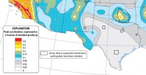
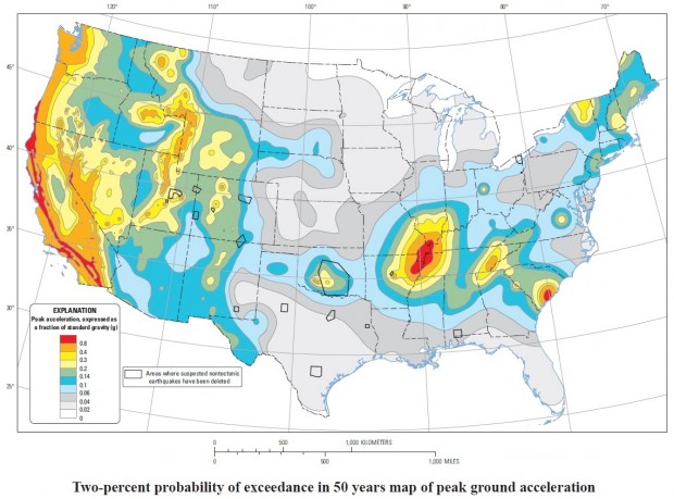
The current map delineates "non-tectonic" quake activity in areas where man-made earthquakes have been studied.
“It’s not easy in the case of induced seismicity. The seismicity models seem to change very rapidly, and they change based on financial decisions, economic decisions, and public policy decisions,” Peterson says. “And that makes it difficult for us to forecast the future.”
According to Peterson the new maps will be based on shorter periods of time so that predictions and decisions can be made based on seismic projections for the next year in advance.
Maps updated in 2014 did indicate areas of “nontectonic” induced earthquake activity in Texas. But Peterson says the new maps will makes those distinctions clearer. In initially, they will include different forecast scenarios based on different theories about man-made quakes.
“So we’re playing with different input parameters trying to understand what the impacts would be for hazard,” he says. “In the end we need to make some final decisions on what we want to say to the public about these different models, and what the USGS feels like is the best available science in this area.”
He expects that preliminary maps including different scenarios for earthquake hazard in the next few months. A final model would be coming out after that.
“I think that people need to be aware that there is an earthquake risk associated with these induced earthquakes,” he says.


