Where the Keystone XL Pipeline Would Go Through Texas

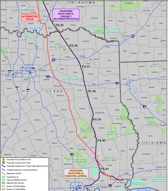
Map by the Department of State
The Keystone XL pipeline would take oil from Canada to refineries in Texas
An announcement is expected later today that will delay the construction of the Keystone XL pipeline. In the meantime, let’s take a look at where the pipeline would go through Texas.
Which counties in Texas would be affected by the Keystone XL pipeline? Here’s a map from the State Department that outlines (in purple) the approved route of the Keystone XL pipeline from Cushing, Oklahoma to refineries in Texas:
Map by the Department of StateThe Keystone XL pipeline would take oil from Canada to refineries in Texas. You can click on the map to see a larger version.
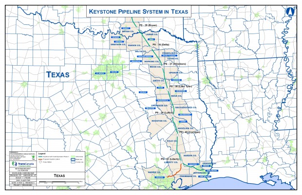
And here is another map of the proposed pipeline by TransCanada, the company behind it:


