The Rain in Texas is Mostly… Well, Everywhere
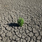
We’ve posted so many maps of the drought over the past few months here at StateImpact Texas. The drought across the state, the drought compared to the rest of the world, even the drought as seen from space.
So we’re happy today to share a map of a different color. Here’s the rainfall in Texas from Monday, according to the National Oceanic and Atmospheric Administration (NOAA):
But the rain isn’t necessarily all-around great news.
Houston, where you can see some violet spots, had up to six inches of rain in some parts of town and suffered flooding. A couple of tornadoes even touched down, which the NOAA is investigating. One of them, in Fort Bend, just southwest of Houston, had the distinction of being the first tornado of 2012, with winds up to 95 mph, damaging several homes.
And while every bit of rain counts, the drought is far from over, and real relief may not come until the fall. As state meteorologist George Bomar testified before a state senate committee meeting on the Texas drought today:
“The bottom line appears to be this: The rest of this winter will be quite dry, and there is little to suggest spring will live up to its potential to end our drought. Even the approaching summer does not appear capable of producing the kinds of rains we need, especially if the hurricane season is as uneventful as last year’s. We have little reason to expect major relief from drought—especially the “hydrologic” variety—until deep in 2012, if then.”
In other extreme Texas weather news, Midland continues to get more snow than some typical wintry locales. The city has had 19.3 inches of snow fall since the beginning of December, more snowfall than Denver has had since then. And beating a previous record from the 1940’s of 13.9 inches, according to the Midland Reporter Telegram.
Here is a collection of tweets and Facebook updates from the scene in Houston yesterday:


