With a Rise in Man-Made Quakes, a Search for More Data
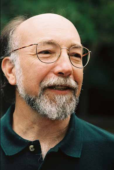
Photo by USGS
William Ellsworth is a scientists with the United States Geological Survey.
Another earthquake swarm has been shaking towns in the Dallas-Fort Worth area over the last few months, with over thirty quakes measured since the beginning of November. Residents are shaken up, regulators have no answers, and no one is sure what comes next.
The likely culprit behind the quakes isn’t fracking, but rather a byproduct of it — hundreds of billions of gallons of wastewater from oil and gas drilling. The disposal of that wastewater deep underground has been known to cause faults to slip, triggering earthquakes in parts of Texas. There were under a hundred recorded earthquakes (measuring 2.0 or higher) in Texas during the three decades before the current drilling boom began in earnest in 2007, according to records from the United States Geological Survey (USGS). Since then, there’s been two hundred quakes recorded by the agency, along with hundreds more smaller ones.
The rate has increased from an average of three quakes a year in Texas before 2007 to nearly 30 a year since. “The increase in earthquakes is very clear, so it’s not an instrumental artifact,” says William L. Ellsworth, a seismologist with the USGS. “This we’re really quite confident of.” And the rapid increase in quakes isn’t unique to Texas: our neighbors to the north in Oklahoma have had an average of 40 quakes measuring 3.0 or higher a year since an uptick in drilling (and oil and gas wastewater disposal) in 2009. Before that, the state had one to three quakes a year of 3.0 or higher on average.
But to establish a link to drilling activity (and specific disposal wells) in each earthquake swarm, scientists need data. And they need a lot more of it when it comes to Texas. To look at how earthquakes are measured in the state and better understand the numbers, StateImpact Texas reached out to Ellsworth, who’s been studying the manmade quake phenomenon in Texas and other parts of the country.
StateImpact Texas: Can you explain how we monitor earthquakes?
Ellsworth: The way we detect earthquakes is that we have instruments called seismometers that measure the vibrations that are created in the earth when the earthquake source slips. When the fault moves, it sends out shaking waves – seismic waves – and those can be detected by very sensitive instruments.
The strength of the waves decays as you move away from where the earthquake occurred, and so the closer you are, the more sensitive your instrument, the more earthquakes you can pick up.
In most parts of the Central and Eastern US, including Texas, the instruments are rather widely spaced. Several hundred kilometers between them, commonly. And that limits our ability to detect earthquakes to about magnitude 3.
Sometimes we see a few smaller ones. But we know there are many, many smaller earthquakes that go undetected just because of the coarse spacing of instruments in the network. If we increase the number of stations, we’ll see more earthquakes. And that’s often what we need to do to get very precise measurements of where earthquakes are occurring.
StateImpact Texas: Then as we put in more instruments, are we seeing more earthquakes? Could the increase in number of earthquakes be in part due to just having more instruments installed?
Ellsworth: We’ll see more earthquakes if we install more instruments. In California, for example, the stations are spaced every ten miles roughly, and we see earthquakes down to magnitude 1 routinely. So if we detect earthquakes at magnitude one, we only expect one in a hundred earthquakes will be magnitude 3 on average.
In a state like Texas, where the detection level is about magnitude three, there are probably a hundred magnitude 1 [earthquakes] that go undetected. So there is an issue about whether detection thresholds are changing with time and whether the increase in earthquakes reflects that.
We’ve looked into that very carefully. And if we look at a level of magnitude 3 the increase in earthquakes is very clear, so it’s not an instrumental artifact. This we’re really quite confident of.
The challenge is that with the very coarse regional network at the present time, it’s difficult to get accurate determination of where the earthquakes are occurring. And that’s one of the keys obviously to understand why they are occurring.
StateImpact Texas: Is there a maximum distance where we can be able to detect an earthquake, or does that vary depending on the region you’re looking at?
Ellsworth: So in many parts of the midcontinent, including Texas, the standard earthquake locations that are routinely produced by the United States Geological Survey will have errors on the order of five to perhaps as many as ten miles. We know this through some very detailed studies that we’ve done.
For example, we’re working with researchers at Stephen F. Austin University and at the University of Texas at Austin. We looked at some earthquakes in the area of Timpson and East Texas. The routine earthquake locations there were off by about five or six miles, so we know there are these large uncertainties.
And this is where auxiliary information such as the shaking information that people can report to the USGS website can be very valuable. This helped us substantially in studying the earthquakes that are still in progress northwest of Dallas near Azle. The shaking reports helped us design where we wanted to put temporary instruments, and those really have brought a lot of clarity to where the earthquakes are occurring today.
StateImpact Texas: Are there any other monitors in addition to the USGS ones?
Ellsworth: A few years ago, there was a very large temporary seismic network called US Array that has been marching across the country for a number of years. And when it passed through Texas, the instruments were spaced on the average of about 50 miles apart.
This provided a temporary window with much greater sensitivity in terms of earthquake size that we could detect, and also better location capability. My colleague Cliff Frohlich at UT Austin used that to study the earthquakes in the general area of where the Barnett Shale is being exploited for gas. And he found that there are many earthquakes that had gone undetected by the regional network, and he was able to locate the earthquakes much more precisely.
So this is an example of where having a denser seismic network – in other words, more stations per mile, if you will – permits us to do a better job of determining where the earthquakes are occurring, and also seeing smaller earthquakes that can often be the clue to the fact that larger earthquakes might follow.