When Will the Texas Drought End?

Map by ERCOT
The Texas grid is forecasting a dry, hotter-than-normal summer. This map shows what percentage of normal rainfall different parts of the state can expect.
Sno Cone stands are open, school’s almost out, and thermometers across the state are getting closer and closer to reading a hundred, if they haven’t already. As another summer approaches, Texans are wondering what kind of season is in store.
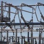
If the forecasts of meteorologist Chris Coleman turn out to be correct, this summer may well be a hot one, though not as bad as the record-breaking summer of 2011. Coleman is the new meteorologist for the Electric Reliability Council of Texas, or ERCOT, which manages the power grid that serves most of the state.
He was brought on six months ago to develop forecasts for the grid’s managers. As power supplies tighten, and the state’s population grows (along with hotter-than-normal summers), Texas finds itself with shrinking margins of reserve power in case something goes wrong on the grid. And power demand is forecast to reach a record level this summer in Texas, even though temperatures aren’t likely to be as hot as they were in 2011.
While forecasting isn’t new to ERCOT (it’s been contracted out for the most part up until now), Coleman hopes to bring a more robust approach, using more data than before. “I’m working to see how accurate the forecasts in place were, and adding my forecast to the mix,” Coleman said Friday at a meeting held by the Gulf Coast Power Association. “Every forecaster has their own approach.”
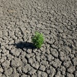
There have been two constant questions ever since the record heat and drought of 2011, Coleman says: Will we have another 2011? And how long will the drought continue?
“I wish I had a very easy answer that would make everyone happy,” Coleman says. “But more than likely, this is a long term drought. We’ve probably got a least another couple years.”
Coleman uses the past more than anything as a guide to the future. He searches for years and seasons that have the same indicators as what we’re experiencing now, things like similar ocean temperatures, jet stream movements, winter temperatures and more. From there he makes a projection. And right now he’s seeing a lot of similarities with another devastatingly dry period in Texas history: the drought of record of the 1950s, which lasted seven years.
“It’s a very similar set up to what we’re seeing right now,” Coleman says. “It turns out, when the Pacific is cool, and the Atlantic is warm, you get drought in Texas.”
That’s because there hasn’t been an El Nino weather pattern for several years — warmer-than-normal ocean temps in the tropical region of the Pacific.
“Here in Texas, if you want rain, you need an El Nino,” Coleman says. “We haven’t really flipped the switch. There’s been some exceptions, but they’ve been isolated.”
The state is worse off drought-wise than it was a year ago, and it’s likely to get worse in parts of Texas, Coleman says, in places like West Texas and some of the southwestern border counties.
This summer is also likely to be hotter than normal, Coleman says, but it won’t repeat 2011. That’s because there’s much higher soil moisture this time around, and we’ve had a cooler spring. Still, the last three summers have been among the state’s top 15 hottest in recorded history, with 2011 being far and away the hottest on record. ERCOT forecasts there will be enough power to avoid blackouts this summer, but that reserves will be “tight.”

If there’s a silver lining to the general lack of rain clouds and higher temperatures, Coleman is also forecasting a quieter hurricane season, with just a small chance of a named storm hitting the Texas coast. That puts his forecast at odds with a recent federal analysis.
Hurricane forecasting is “probably the most difficult to forecast” compared with temperature and precipitation, Coleman says. “So much of it pertains where you’re living, and whether it impacts you,” he says. But he predicts just a few named storms for the Gulf, with a small chance of one becoming a hurricane and making landfall on the Texas coast.
While this is welcome news for many, it also means a drought-busting tropical storm or hurricane is less likely this season.
Forecasters will be watching this summer to see if the El Nino weather pattern could return in the fall, and with it better chances for substantial rains. But Coleman is skeptical.
“I think we’re a ways off yet from seeing any substantial El Ninos,” he says. “Keep your fingers crossed.”