Background
La Niña is a weather pattern where the surface temperatures are cooler in the Pacific, which creates drier, warmer weather in the southern U.S. (You may also know her counterpart, El Niño, which generally has the opposite effect.) La Niña sticks around for a year, sometimes longer, and tends to return once every few years. (The last La Niña was in 2007, but it was a much lighter one.)
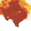
The National Weather Service says that a “majority of models predict La Niña to weaken through the rest of the Northern Hemisphere winter 2011-12, and then to dissipate during the spring 2012. They “expect La Niña impacts to continue even as the episode weakens.” They say that during the next few months, it’s likely to be drier-than-average in the south. But what are the odds of La Niña coming back this fall and extending the drought even further? When La Niña showed up in the summer of 2010, she overstayed her welcome, returning the very next year for back-to-back La Niñas, which became a major factor in the drought.
So is this was a “double-dipping” La Niña, what are the chances of a three-peat? History would tell us the odds are 50/50. In five out of the last ten two-year La Niñas, they were followed by a third year of the pattern. Texas state climatologist John Nielsen-Gammon told StateImpact Texas in January that there’s “no guarantee” that won’t happen this time, which would take the record single-year drought into even more extreme territory.


