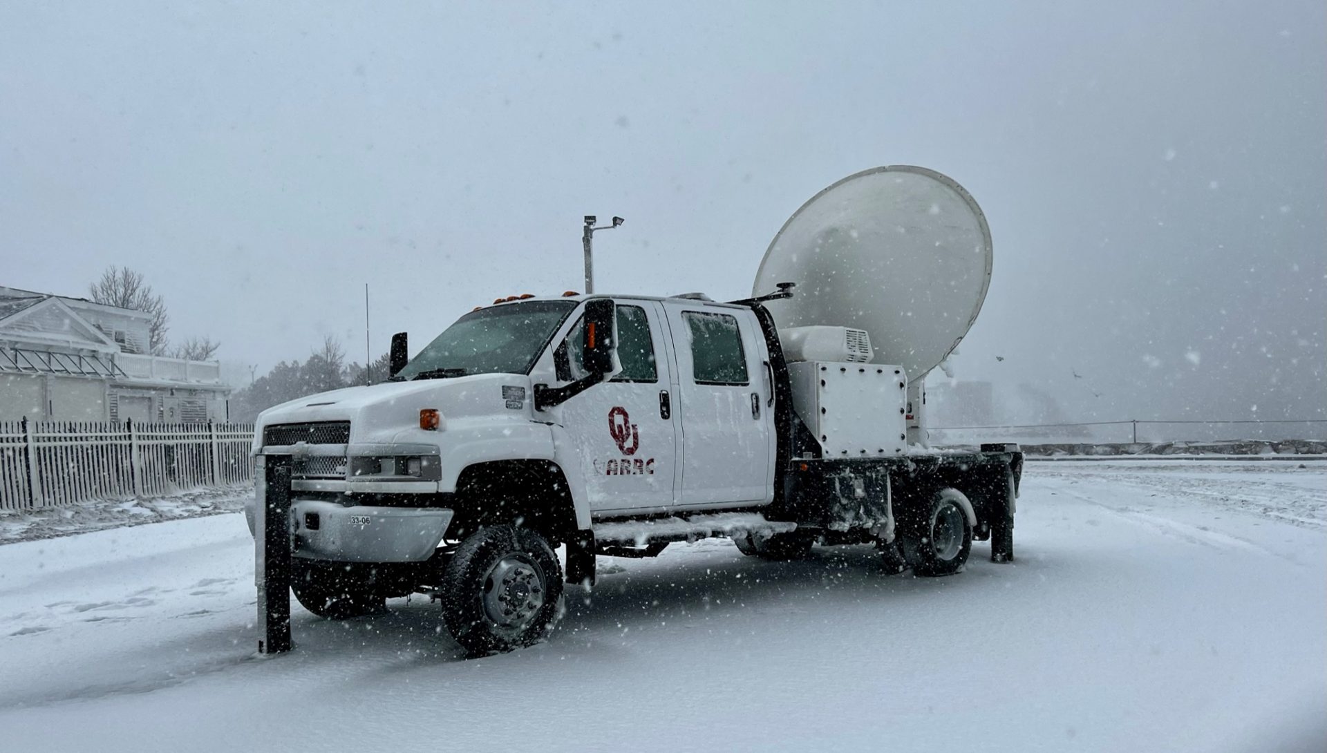
The RaXPol system sits on the back of a truck at Plymouth Harbor. (Photo courtesy of David Schvartzman/ University of Oklahoma RaXPol)


The RaXPol system sits on the back of a truck at Plymouth Harbor. (Photo courtesy of David Schvartzman/ University of Oklahoma RaXPol)
Howie Bluestein was waiting for the right storm. On Jan. 28, that storm arrived.
The OU meteorology professor had been watching his weather maps and computer models for days. The date of the incoming storm was approaching, but the models disagreed about if it would even touch much of the East Coast.
“So here we are,” Bluestein recalled. “It’s basically 48 hours before the event. I had to make a decision.”
Bluestein and his team of radar scientists made the call to board a plane to New York and then drive their radar truck to Massachusetts to do something that had never been successfully done before: study large snowstorms with their radar on the ground while NASA planes collected data from the skies.
The research is part of NASA’s IMPACTS program, which stands for “Investigation of Microphysics and Precipitation for Atlantic Coast-Threatening Snowstorms.” In the program, NASA flies a suite of remote sensing planes into snowstorms to understand how snow particles work across snowbands, and how snowbands form and evolve. The hope for the data collected is to significantly advance the ability to predict snowstorm characteristics.
Bluestein and his team made up the ground crew for data collection. Their radar truck, which had been parked at the wharf at Plymouth Harbor the night before, was underwater from the high tide. With 70-mile-an-hour blizzard winds blowing around them, they waited until the tide went down, got in the truck and began over nine hours of data collection.
You know it’s an epic storm when legendary research meteorologist Dr. Howie Bluestein from @UofOklahoma shows up with @raxpol and weather radar expert Dr. David Schvartzman.
They were observing the #Blizzard and supporting the NASA @SnowIMPACTS campaign.@OUARRC@ousom pic.twitter.com/DOEFh3Ttg0— Mike Seidel (@mikeseidel) January 29, 2022
NASA’s P-3 plane flew above the researchers, collecting data about the types of cloud particles and precipitation particles. Another plane, an ER-2 model, was prevented from taking off in North Carolina until the strong crosswinds died down. By the time it arrived, the snow was ending. Regardless, Bluestein said the data collected from the P-3 and his ground team is “quite valuable.”
The January event wasn’t NASA’s first field program, but it was the first nor’easter of the program, and it was the first time Bluestein’s team had been involved.
“[NASA had] never even got a big storm like this,” Bluestein said. “So it’s beginner’s luck for me.”
The RaXPol system, maintained by the Advanced Radar Research Center (ARRC) at OU, usually operates more locally, probing severe thunderstorms and tornadoes. It sends polarized beams of radiation, one vertically polarized and one horizontally polarized, to the precipitation, which “scatters” the radiation back to the radar. The RaXPol measures the cross section of precipitation particles, and based on the amount of vertical radiation relative to horizontal radiation, scientists can tell what kinds of particles are in the air — large and small water droplets, ice, hail and more.
The data from the ground are combined with data collected from the NASA plane, which gives researchers a more complete picture of what’s happening during a snowstorm.
“We’re trying to learn: under what circumstances can you get heavy snow? Under what circumstances [can] we get not-so-heavy snow? Under what circumstances will you get different types of snow crystals?” Bluestein said. “So you kind of attack it with a lot of instruments that measure different things.”
Bluestein said this grant-funded initiative from NASA only covers the field program, so analyzing the data will take more funding and will be done in part by other researchers. He said sorting through the data could take six months, and it will probably be another 1-2 years before scientists can draw conclusions about it. Though storms on the East Coast and the Southern Plains are different, he said what the researchers learned about clouds in Massachusetts can be applied to storms in Oklahoma.
As far as braving blizzard conditions again for another trip up to the East Coast, Bluestein said he’s ready for whatever this winter throws at him. While he doesn’t think another big East Coast snowstorm is likely this season, he said if it happens again, his team will be there.
“Otherwise, this was a once-in-a-lifetime experience, because no one’s ever done this before with a storm of this magnitude with a radar like this,” Bluestein said. “So this may be my one shot, but you never know.”