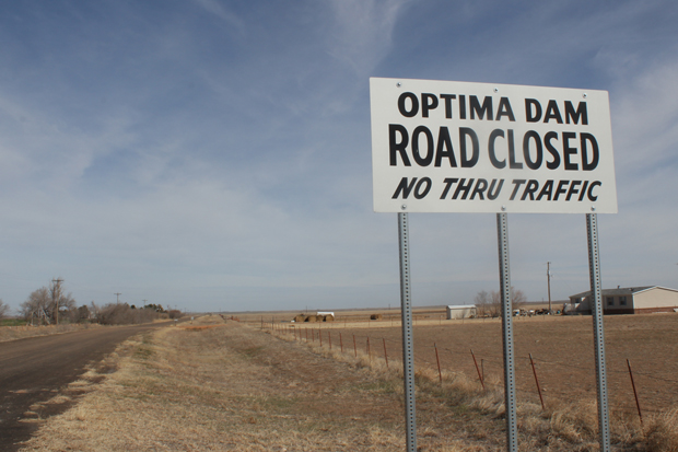
About three miles past this sign is the recently closed road across the three-mile long Optima Dam. The road was closed after money to make repairs to guardrails could not be found.
Logan Layden / StateImpact Oklahoma


About three miles past this sign is the recently closed road across the three-mile long Optima Dam. The road was closed after money to make repairs to guardrails could not be found.
Logan Layden / StateImpact Oklahoma

Logan Layden / StateImpact Oklahoma
About three miles past this sign is the recently closed road that traverses Optima Dam. The road was closed after money to make repairs to guardrails evaportated.
Lake Optima is perhaps the biggest failure in the Corps of Engineers’ long history of building reservoirs. It took 10 years of planning and construction to build the dam, at a cost of almost $50 million. Panhandle leaders had been pushing for a large lake for decades before that.
It was supposed to provide flood control and a supply of drinking water to several communities, and attract millions of campers, water skiers and anglers.
Lake Optima did none of those things. It never filled.

Logan Layden / StateImpact Oklahoma
Guymon, Okla. City Councilman Kim Peterson at Hunny's, the local BBQ joint he owns.
The Oklahoma Panhandle took the brunt of the Dust Bowl of the 1930s. The dirt storms were devastating, but so was the occasional flooding in Beaver River, known as the North Canadian further down stream.
Farmers responded to the Dust Bowl by changing the way they grew crops, says Guymon City Councilman Kim Peterson.
“When we would have rains, there would be runoff that would settle down in the rivers,” Peterson says.
Water conservation practices for farmers — such as terracing and no-till farming — were put into place after the Dust Bowl, he says. These measures help keep precious rainwater in the ground.
“It doesn’t run down the creeks and draws into the river like it used to,” he says. “So it would take quite the climate change for that place to ever fill up.”
But that’s not the only reason Lake Optima never filled. The source of the Beaver River is the vast, underground Ogallala Aquifer, which reaches into eight western states. Agricultural and population growth in this part of the country meant more pressure on the aquifer, dropping its water level and reducing the river to little more than a trickle.
The result is a massive, three-mile earthen dam and flood control gate that serves practically no purpose. What’s left of Lake Optima now is a large, muddy puddle about six inches deep just below the dam.
More farmers and new farming practices conspired to doom the reservoir. So why didn’t the lawmakers who fought for the project and the engineers who built it see the failure coming?

Logan Layden / StateImpact Oklahoma
The view up at the flood control tower at Lake Optima from what should be the bottom of the reservoir.
Ed Rossman, planning branch chief for the Corps of Engineers’ Tulsa District, says if construction on the dam had been finished in 1968 instead of 1978, the lake would’ve filled.
“Between 1937 and 1966 there were an averages of 32.2 cubic feet per second,” Rossman says. “In the period between 1977 and 1986 that was down to 7 cubic feet per second. So, basically, the flows in the river changed.”
The problem was that the Corps used historical climate data to determine the best spot to build the dam. Rossman says that data was wrong by the time construction was completed. If the relationship between groundwater and surface water was better understood, things might have been different. Now the Corps knows there’s a connection between aquifers and the streams and rivers they feed, and it does things differently now.
“We know that the historic record may not be a good snapshot for the future,” Rossman says. “All we had to go on in the 50s and 60s was just what was recorded in terms of stream flows, and now we have the ability to use evidence from soils and tree rings to expand the historic record to capture some of those cycles in the climate.”
The risk of these forecasts being wrong also figures more prominently into the calculations used to plan modern projects, Rossman says.
“All federal agencies right now are looking at climate variability and asking the question: ‘Is what we’ve experience over the past 50 years or so going to be a good predictor for what it will be in the future?'”