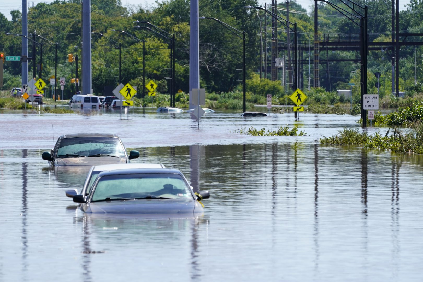
Vehicles are under water during flooding in Norristown, Pa. Thursday, Sept. 2, 2021 in the aftermath of downpours and high winds from the remnants of Hurricane Ida that hit the area. Scientists say climate change is contributing to the strength of storms like Ida.
Matt Rourke / AP Photo
Penn State expanding weather network, offering data that could help areas prepare for floods
I report on energy and the environment for StateImpact Pennsylvania at WITF.
My work focuses on responses and solutions to climate change in the state legislature and communities around the state. I trace my interest in these issues back to my time as a Girl Scout and this episode of Rocko’s Modern Life.
I look forward to winter just for the chance to ski a few times each season. I try to keep myself from doom-scrolling on my phone by keeping my hands busy knitting and learning to play the piano.
I grew up in Cambria County, Pa. and graduated from Temple University. I started at WITF just after Christmas in 2014.
Matt Rourke / AP Photo
Vehicles are under water during flooding in Norristown, Pa. Thursday, Sept. 2, 2021 in the aftermath of downpours and high winds from the remnants of Hurricane Ida that hit the area. Scientists say climate change is contributing to the strength of storms like Ida.
Penn State is expanding a tool to give the public access to weather information across the state.
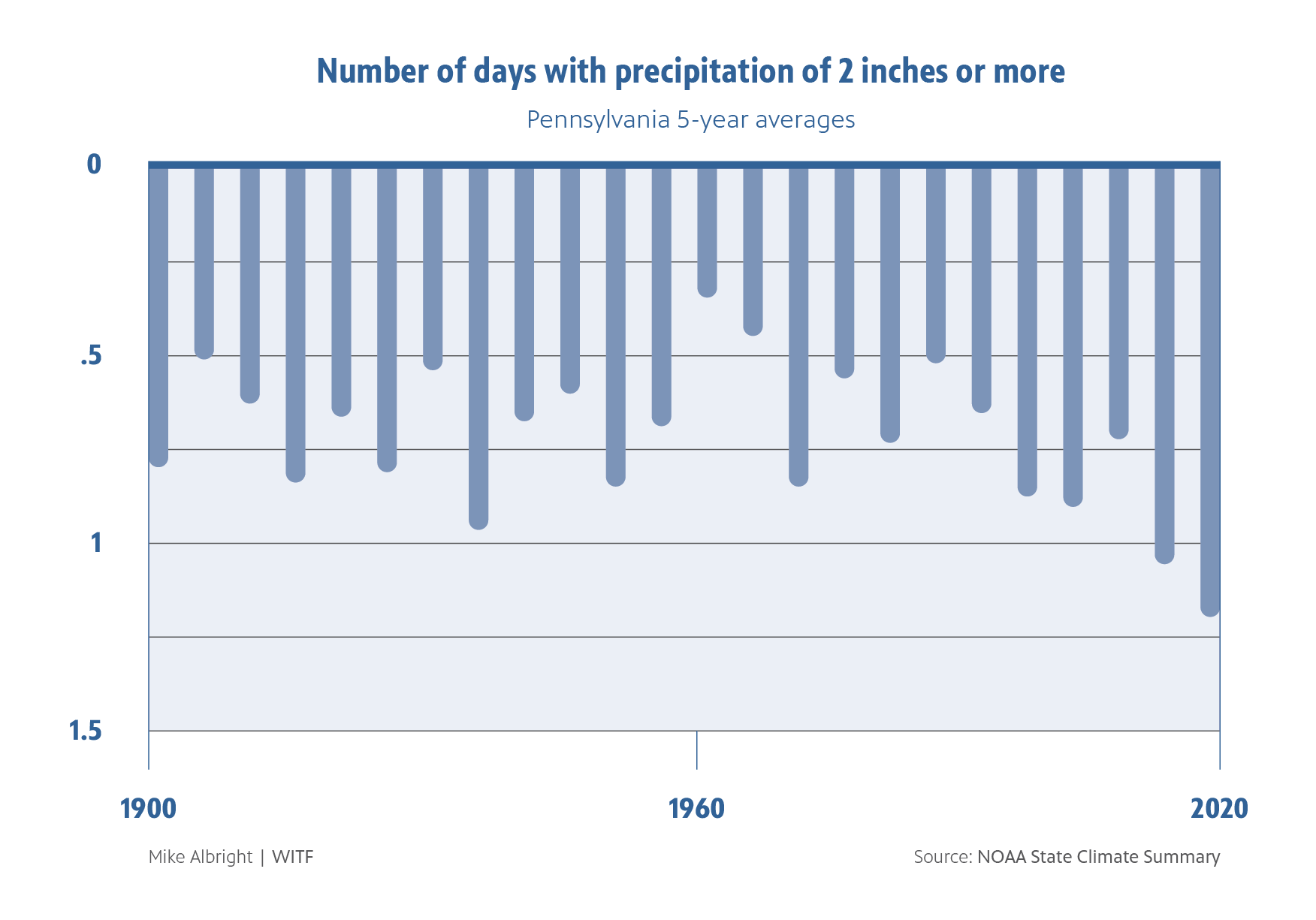
Data from the project could help communities prepare for severe storms and flooding, which are expected to increase in Pennsylvania as the climate changes.
Penn State started installing stations for its statewide environmental monitoring network in 2019. It’s up to 17 stations in operation, with 3 more near completion. The stations are spread fairly evenly, geographically, across the state. Paul Heinemann, a professor of agricultural and biological engineering and a leader on the project, said the team drew a grid over the state to determine the first 20 locations. They did not put any in the southeast corner of the state, because it would overlap with Delaware’s weather network.
Now with a federal grant administered by the Pennsylvania Emergency Management Agency, the university will grow that number to 50. The locations of the 30 new sites have not been finalized. Penn State says the ultimate goal is to have one station in each county.
The solar powered stations have a battery power backup and collect data on air and soil temperature, humidity, solar radiation, air pressure, wind speed and direction, rainfall and soil moisture.
Heinemann said the measurements will be useful for students, utility companies, and emergency managers.
“They see the need for rapid and real time measurements and this is especially true for the potential for flood events,” Heinemann said.
Heinemann said current and past data from the stations is available online, so planners can better track changing conditions.
PEMA spokesman Paul Vezzetti said information from the new sites adds to an existing system that is used to send early alerts to emergency managers on heavy rain events.
“Regularly monitoring a wider range of weather parameters in real-time will better inform the decision-making and situational awareness of emergency managers on the ground, and enhances everyone’s ability to prepare for severe weather,” Vezzetti said. “PEMA’s top priority is the health and safety of Pennsylvanians, and being prepared to respond to any emergencies the Commonwealth may face.”
There are other weather monitoring efforts in the state, but Heinemann said Penn State’s network is meant to make the data more widely available. Some networks require a subscription, and different stations may take different measurements. The information from the Penn State stations is publicly available and standardized
The weather stations are now positioned at Penn State campuses and research facilities, state parks, and airports. Many of the new stations will be placed at K-12 school campuses. A curriculum for the environmental data is being developed in collaboration with Greencastle-Antrim school district.
To view the data, visit this site and select the PEMN network.
StateImpact Pennsylvania is a collaboration among WITF, WHYY, and the Allegheny Front. Reporters Reid Frazier, Rachel McDevitt and Susan Phillips cover the commonwealth’s energy economy. Read their reports on this site, and hear them on public radio stations across Pennsylvania.
Climate Solutions, a collaboration of news organizations, educational institutions and a theater company, uses engagement, education and storytelling to help central Pennsylvanians toward climate change literacy, resilience and adaptation. Our work will amplify how people are finding solutions to the challenges presented by a warming world.